Wetlands: Bahia Grande, 1
Tuesday, May 21st, 2013
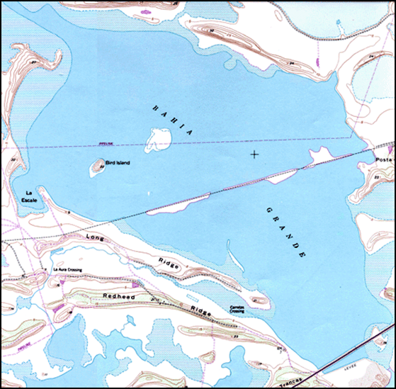
Bahia grande Map, Texas A&M Corpus Christi
This is Passport to Texas
Bahia Grande, the largest tidal wetland restoration project in the state of Texas, is getting closer to completion.
10 – A tidal wetland is normally a coastal wetland that is influenced by the daily tide cycle that would basically push or pull water into that system on a daily basis.
John Wallace, Deputy Project Leader South Texas Refuge Complex, says construction of the Brownsville Ship Channel in the 1930s effectively cut off Bahia Grande from the gulf.
09 – The spoil from that ship channel was piled on the north side, and it blocked off those natural channels that allowed water to flow into the Bahia Grande.
Without water, the basin dried up, and eventually became a nuisance to local residents and businesses whenever prevailing winds came from the southeast.
26 – Normally on a coastal area with prevailing winds, you would get winds ten to twenty miles an hour every day. And these winds would pick up that real fine clay dust, and blow it to the north and northwest. And the local communities north of there were suffering from this blowing dust. It was impacting people that had breathing problems. The local schools, their air-conditioning systems, it was getting into the classrooms. So, it was a major concern for the local communities.
Solving the problem…that’s tomorrow.
The Wildlife & Sport Fish Restoration Program supports our series and provides funding for wetland conservation through the Private Lands Enhancement Program.
For Texas Parks and Wildlife…I’m Cecilia Nasti.


 Passport to Texas is a
  Passport to Texas is made available by: